


Marine Weather Forecast API
Wave height, direction and period forecasts with 5 km resolution

Marine weather forecasts are now available at Open-Meteo.
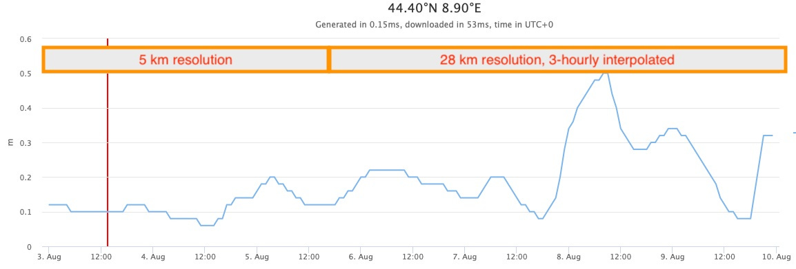
The Marine Weather API is using global wave models from the German Weather Service (DWD) with 28 km resolution and European models with 5 km resolution. Both models update twice daily and provide forecasts for 7 days.

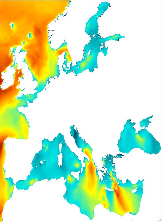
The 5 km European model covers the United Kingdom, southern coasts of Norway, the Mediterranean sea, France and Western Africa until Mauritania. The map below shows exact data coverage.
The European and global wave models are integrated seamlessly. For API calls with a coordinate in Europe, the high resolution 5 km model will be selected automatically.
The European model forecasts only 3 days. The API transparently combines both models. The first part of the forecast takes high resolution forecasts and switches to a global model after 3 days. Because the global model offers only 3-hourly data, data is interpolated to 1-hour resolution.
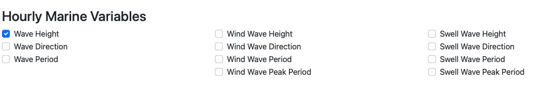
Marine weather variables are available for wind, swell and combined waves.
Swell waves are moving away from large storms and can travel long distances. Wind waves directly caused by local prevailing winds. Both can be combined to get a simple indication for wave height, direction and period.
For many applications, the combined wave height and period is already sufficient. For more advanced applications to find the best surf spot, detailed information about swell waves is more important.
The API offers wave height, direction, period and peak period separately for wind, swell and combined waves.
The Marine Weather API is now available for free for non-commercial use and can be used without any API key.
If you are looking for additional weather or environmental datasets that Open-Meteo can integrate, leave a comment!