


New Weather And Marine Models Integrated
UK MetOffice, ECMWF AI-enhanced AIFS, Copernicus Marine Wave with Currents and Tides

Over the last months, plenty of new open-data weather models have been integrated into Open-Meteo. Here is a brief list of what’s new:
UK MetOffice Global and UKV model
The UK Met Office, the national weather service of the United Kingdom, has released its UKMO models as open data. This includes a global model with a 7-day forecast and a high-resolution local area model for Britain, providing particularly accurate forecasts for the region.
However, the open-data distribution has a built-in delay of 4 hours, making the high-resolution forecasts for Britain less reliable for short-term predictions.
UKMO Global:
Global 0.09° (approximately 10km).
7 days of forecast with 1-hourly data for up to 4.5 days, 3-hourly up to 6 days and 6-hourly for the 7th forecast day.
Updates every 6 hours, but 4 hours additional delay.
Weather parameters include common surface parameters as well as 33 atmospheric pressure levels.
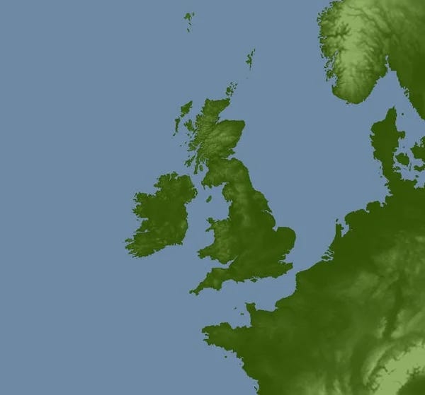
UKMO UKV Britain:
Local area model around Britain at 2 km resolution (see below).
2 days forecast with 1-Hourly values.
Updates every hour, but 4 hours additional delay.
Along common surface variables and 33 pressure level, UKV includes 33 height levels ranging from 2 metre to 6000 metre above ground.
Forecasts for the global and local area model are available in the Open-Meteo UK MetOffice API.
UK MetOffice Ensemble Model
Additionally, the UK Met Office has released its ensemble weather model, featuring 18 perturbed forecast members. With a resolution of 20 km, it is lower than the UKMO Global model, but due to the increased data volume, it is common practice to publish ensemble models at a lower resolution.
MOGREPS-G:
Approximately 20km.
7 days of forecast with 1-hourly data for up to 4.5 days, 3-hourly up to 6 days and 6-hourly for the 7th forecast day.
Updates every 6 hours.
Common surface variables.
UK MetOffice ensemble forecasts are available via the Ensemble API, alongside ensemble models from ECMWF, DWD, NOAA, BOM, and Environment Canada.
ECMWF Open-Data AIFS 0.25° Single
ECMWF has released an updated version of its AI-enhanced weather model, AIFS. The new version, called AIFS Single, is now available as open data with a 0.25° resolution. Notable improvements include:
More surface parameters, such as snowfall, convective precipitation, solar radiation, soil temperature, and moisture.
Enhanced upper air pressure level forecasts, now directly providing wind speeds for pressure levels and the 100 m wind level.
Cloud cover data for low, mid, high, and total atmospheric levels, eliminating the need for post-processing by Open-Meteo.
No additional delay in open-data distribution. AIFS 0.25° Single is available approximately 5:45 after initialization, with Open-Meteo requiring just 8 minutes for download and processing.
The addition of solar radiation forecasts and 100 m wind speeds is particularly valuable. With faster data availability, AIFS 0.25° Single could be the first AI weather model suited for medium-term renewable energy forecasting.
The main limitation remains the 6-hourly data intervals, which are challenging for solar radiation forecasts. Open-Meteo addresses this using specialized interpolation algorithms based on NREL’s Solar Position Algorithms to provide 1-hourly or even 15-minute forecasts.
AIFS 0.25° Single:
Global 0.25° (approximately 28 km).
16 days forecasts with 6-hourly values.
Updates every 6 hours, without artificial delays. Data available after 5:45 hours after initialisation.
Common surface variables, 100m wind, solar radiation, 12 atmospheric pressure levels.
More information on the ECMWF AIFS 0.25 Single model is available in the ECMWF documentation. Data for various ECMWF models, including IFS 0.25 and both the old and new versions of AIFS, can be accessed through the Open-Meteo ECMWF API.
ECMWF Open-Data IFS 0.25°
At the end of 2024, the regular ECMWF Open-Data IFS 0.25° was updated with additional variables:
Soil temperature and moisture for four depth layers: 0-7, 7-28, 28-100, and 100-255 cm below ground.
Precipitation type (e.g., rain, freezing rain, snow, or convective precipitation).
Gusts at 10 meters above ground.
The addition of precipitation type is especially useful, as it now allows for a more reliable estimation of snowfall amounts and showers. Previously, Open-Meteo had to approximate snow using a temperature-based threshold.
IFS 0.25° has been available as open data for over a year and has been running very reliably. The older IFS 0.4° resolution is still accessible, but we’d like to remind everyone that it’s past its deprecation date—so if you haven’t already, now’s the time to upgrade to 0.25°!
For Open-Meteo users, switching is as easy as updating the model selection from “ecmwf_ifs04” to “ecmwf_ifs025”. And who knows—maybe one day, the next step will be “ecmwf_ifs01” 😃.
Copernicus Marine Wave and Currents
The Open-Meteo Marine API has undergone a major update, now featuring additional models from the Copernicus Marine project. Wave and Ocean Currents models based on MeteoFrance have been integrated, and all historical data has been downloaded, allowing instant access to years of data with a single API call.
MeteoFrance MFWAM:
Global 0.083° (approximately 8 km)
10 days forecast with 3-hourly values
2 updates per day
Wave forecasts with wind and swell components
Historical data from October 2021 onwards
MeteoFrance SMOC Surface Merged Ocean Currents
Global 0.083° (approximately 8 km)
10 days forecast with 1-hourly values
1 update per day
Ocean currents (velocity & direction), sea level height considering tides, sea surface temperature SST
Historical data from January 2022 onwards
While tide forecasts are now available, they should be used with caution. We do not recommend relying on them for coastal navigation for two key reasons:
The model operates at an 8 km resolution, which cannot accurately capture complex coastlines. Tides and currents are highly localized, making precise modeling difficult. Some areas, such as Vancouver, experience significant deviations due to constrained water flow. However, forecasts for open coastal harbors tend to be more reliable.
Sea level heights are referenced to the global mean sea level, not the datum used in navigation charts (e.g., lowest astronomical tide, LAT). As a result, direct comparisons are not possible. On the other hand, the SMOC model accounts for atmospheric pressure and other factors that may cause water levels to drop below LAT.
Historical and forecast data is available through the Open-Meteo Marine API.
Outlook
Blog posts have been a bit sparse lately, but that's not because there’s a shortage of open-data models. On the contrary, more weather models are being released as open-data, and by the time we wrap up one, another is already available. As a result, we now have quite the backlog of exciting new models.
Over the past few months, we’ve significantly upgraded our server infrastructure to handle and publish more data. This progress is made possible thanks to our commercial clients, but we remain more committed than ever to keeping everything open-data, open-access, and open-source. Isn’t that the core principle of any project that starts with “Open”? 😉
We’re also integrating new datasets and features that will roll out in the next few months. Be sure to subscribe to this blog for free to stay informed!
Excellent news! Thank you for all your hard work!!
Thanks so much for your work!